Motor Boating and Yachting magazine recently published an article I wrote about our Antarctic adventure. You can read a copy here.
Personal Log – Antartica
The following are contemporaneous entries from a personallog that I kept during our adventure. I hope you enjoy:
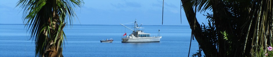
Subject: Jan 21 Update Date: 21 Jan 2019 15:21:07 -0000 From: MCCC5 Greetings from Iron Lady and Grey Wolf cruising side by side at 57 degrees 30 South – some 117 nautical miles SSE of Cape Horn. Forecast is holding – we had crossing swells from the NW and SW overnight, 9 second period. A bit confused as when they reinforced each other, the peaks topped out at 4 to 5 meters. Northerly winds 25 and easing. Sea state this AM down to a 3 meter long swell and light northerly chop. Air temp 2 C. Took the inside passage between Isla Navarino and Isla Lennox last night to pass close by Cape Horn but it grew dark around midnight and we could only see the lights. Did manage to get a picture of Grey Wolf steaming thru the passage with Cape Horn in the background. They got some of Iron Lady against a beautiful sunset. We did get a brief clearing and I managed to get a picture of the Wolf supermoon but, unfortunately, the eclipse was obscured by high clouds. We had roughly 2 hours of darkness last night. It was light again when I went on watch at 0400 but the sun did not rise above the horizon until 0500. Suspect even less tonight but is is light well before the sun rises as it is just below the horizon. To be expected given how far south we are. All is well.
Subject: January 22 Update 1000 Local Date: 22 Jan 2019 13:19:44 -0000 From: MCCC5 Greetings from Grey Wolf and Iron Lady. We are cruising in dense fog about 1.5 NM apart. Present location is 60 degrees 37 minutes South – roughly 165 NM from the Antarctic Peninsula. Weather has been pretty much as forecast. Last night, we passed thru a weak frontal zone and winds dropped to light and variable. Seas are slight with a gentle long swell. Visibilities have varied but have generally been around 50 meters in fog. Barometer has been falling and seems to have bottomed out at 980 mb. Air and sea temp are now down to around 1 C. There was a brief period of darkness that lasted around 2 hours last night. At current speed we will make the pass south of King George island around 0100 local on January 23rd. We may then need to hold station until first light to get into the Frei Station anchorage. We passed our first iceberg last night. Sun is attempting to break thru the fog now so maybe we will see the next one visually other then on radar. The crew were playing the game Battleship over the VHF yesterday – pleased to report we sunk Grey Wolf with only minimal damage. Subject: Arrived Date: 23 Jan 2019 07:48:58 -0000 From: MCCC5 After a difficult approach (for me) with inaccurate charts, ice bits and building seas with an approaching system, we are now anchor down in Yankee Bay at 0315 local. Blowing up to 35 knots on the way in. Running on adrenalin. Fantastic sunrise siloheting the glacier and penguin colonies in the bay, so had to throw the dinks in to experience the moment. Toasted the occasion aboard Grey Wolf with Shackleton reproduction scotch. Cannot begin to describe the rush of navigating these difficult waters in our own boat with challenging navigation, and the stark beauty of being here! Off to bed now – more to come.
Subject: January 24 Update Date: 24 Jan 2019 10:37:40 -0000 From: MCCC5 Made Antartica landfall around 2115 local on January 23. Entry into the Nelson Straight at around midnight. Had 3 to 4 knots of current against us with following seas that built into large standing waves as the water shoaled. Those of you who have been in tight quarters in inlets with opposing wind and tide know how challenging this can be. Most of the charts here are inaccurate. While they accurately depict the size, shape and relationship between land masses; they are not generally accurate in terms of latitude and longitude. This necessitates using parallel index lines on our radar using prominent land features to establish course and safe distances from land masses based on charted water depths. In the case of Nelson, there was very little margin for error. Once thru Nelson, we proceeded south down the Bransfield Straight to Yankee Harbor. Winds were blowing up to 35 knots with ice bits around so navigation in the wee hours of the morning in almost total darkness was a three person affair with two look outs using visual and radar and a helmsman. We made turn into Yankee Harbor and dropped anchor around 0315 local. While everyone aboard both boats were tired, but the thrill of being at anchor in Antarcticawas too much. We put the dinks in the water. Sunrise was spectacular with wonderful shades of purple and pink. Aboard Grey Wolf, we all toasted our safe arrival with Shackleton reproduction scotch. A fitting choice. After a bit of rest, we were all aboard Grey Wolf for brunch and a briefing on Yankee Harbor, the rules for observing wild life, protected areas and boot cleaning to insure no contamination was brought ashore. Then it was to shore to observe the Gentoo penguins and seals. In the afternoon and evening, we watched humpbacks feeding in the Straight close up and did a tour of the glacier at the head of the bay. After dinner and a very long day, everyone went to bed early except those charged with anchor watch necessary due to the nearly constant flow of ice of from the glacier. Particularly necessary since the weather was forecast to deteriorate over night. We have ice poles aboard to push away the smaller chunks. During the day, we used our dink as a tug to push them away. Overnight, Grey Wolf had to start her engines to maneuver out of the way of one the size of the boat. By 0530 today, it was blowing 35 with gusts to 50 knots in the harbor with snow and sleet and 1 meter waves. Glass is down to 974 mb. The surrounding hills are now snow covered. Can imagine what it is like outside the harbor. Looks like a day of anchor watch and boat chores. Cheers
Subject: Jan 25 Update Date: 25 Jan 2019 10:14:02 -0000 From: MCCC5 Weather subsided late in the afternoon on the 24th so members of both parties headed to shore in Yankee Harbor to see some elephant seals. Late in the day, several of us joined Grey Wolf for a trip to Half Moon Bay (about 6 nm distant from Yankee) to see a colony of Chinstrap penguins and some remains of an old whaling boat. Upon return, Grey Wolf could not get back in to Yankee due ice and had to wait outside for several hours. Iron Lady’s dink was able to negotiate the ice so we were back aboard before Grey Wolf could get in. Fast dinner and to bed as we are all exhausted. Standing two hour ice watches. Wind came up again over night and the glass is now down to 968 mb. During the 0200 watch, a massive amount of ice came down from the glacier. The next 3 hours were spent dodging car sized bergs using the engines and bow thruster while still anchored. We were also on deck using ice poles to push some the smaller ones away. No fun in 35 knots with sleet. Long night. Plan is to head to Deception Island today but first need to get some sleep. Short nap. Wind changed direction and all the ice that was past us began to blow back our way. Anchor up and underway at 0700 as it was right on our stern. Back to bed.
Subject: Jan 26 Update Date: 26 Jan 2019 10:54:04 -0000 From: MCCC5 Plan was to depart Yankee around 1000 for Whalers Bay on Deception Island so the ice attack simply resulted in an earlier then planned departure. Deception is around 50 miles or a 5 hour steam from Yankee. I slept until 1100 but upon coming on deck, we had clear skies, light winds and unbelievable scenery. A mammoth ice berg was astern of us and the high cliffs of Deception were in front of us. Deception is actually a volcano with a flooded caldera that is around three miles in diameter. Imagine a bowl full of sea water with the surrounding rim some 500 meters high. At the southeastern corner, the rim has collapsed and is open to the sea provising a narrow entrance to the central caldera. It is called Deception because the entrance is deceptive and difficult to see. Initially, sealers came here and slaughtered some 500,000 fur seals for their pelts. THey effectively wiped out the population and, even today, we only saw a few. They departed when the seal population collapsed, and, on their heels came the whalers. They build a significant infrastructure and the remains of that are still present today. After the whalers, several research stations were located here but they were abandoned as a result of volcanic eruptions as late as the 1960’s. Deception is still geothermaly active today. Sulfurous hot water springs create clouds of steam along the beach in Whalers Bay. After an explore of the ruins, some hiked to Neptunes Notch which overlooks the bay. Shore operations were concluded with a traditional Polar Plunge. Most of us stripped down to bathing suits and shorts and took the plunge quite literally. The first few feet were acceptably warm but by the time one was waste deep, the water was getting down to a more polar like 5 C. Swimming didn’t last long but the air was actually quite warm in the bright sun so I actually took the dinghy back to the boat just in my swim gear. Underway this AM at 0700 bound Enterprise Island some 100 NM south. Got some good pics of penguins on an iceberg and whales as we left Deception. Cheers
Subject: Jan 27 Update
Date: 27 Jan 2019 11:41:15 -0000
From: MCCC5
Left Deception around 0700 as we had a 100 NM south down to Enterprise Island at 64 degrees 32 Minutes south. Spectacular day with bright sunshine and light following winds. As we proceeded south, the icebergs became more numerous and the terrain much more rugged with high peaks, glaciers and snow fields especially on the Peninusla.
We made Enterprise around 7 PM as we did some whale watching along the way and that slowed our progress a bit. The inner harbor at Enterprise is home to an old steel whaler which lies half submerged with the bow up. The guides bill this as a hurricane hole though it doesn’t appear to be one from the charts. We had hoped to side tie both boats along side the wreck which is the preferred thing to do. Unfortunately there was a traffic jam and 4 other boats were already tied alongside leaving no room for us.
We scoured the small bay for several hours looking for alternatives as the next anchorage was 3 hours away and a forecast northeast blow over night made that untenable. Our final solution was to anchor the boats in a northeast/southwest direction and stern tie to rocks on the shore. Grey Wolf anchored to one shore with her bow point northeast and we anchored to the opposite shore with our bow pointed southwest. We each ran two shore lines to the shore behind us and ties off to rocks and bollards that someone had placed there. Apparently we were not the first to come up with this strategy. The boats face each other about 200 meters apart.
The primary remaining problem was two grounded school bus sized bergs in the bay with us. Our concern was that they would float at high tide and drift down on us overnight. We even gave some thought to lassoing them and dragging them out of harms way but abandoned that idea as being too dangerous.
Our strategy was to toss the shore lines and retrieve them later if we had to move in the middle of the night. We also left the dinks in the water to use as tugs to hold the bergs at bay while we moved the boats.
After we had a great dinner, we were off to bed – it was a long day.
Fortunately, no extraordinary measures were necessary as the bergs stayed put overnight. The blow that was forecast is either late coming or isn’t coming at all- just a bit of snow this morning. Point being, however, that everything could have gone pear shaped just as easily. Down here you must of necessity plan for the worst and be grateful when that doesn’t happen.
Grey Wolf is coming over in about 30 minutes to discuss plans for the next few days.
Subject: January 28 Update
Date: 28 Jan 2019 18:18:19 -0000
From: MCCC5
We took the back channel route from Enterprise down to Paradise Bay. Lots of whales, penguins and icebergs along the way. We anchored up near the Chilean Armada Station at Waterboat in Paradise Bay. The prime spots were once again occupied by two yachts so we had to anchor off and put out shore lines. We actually ended up pulling the sterns of the two boats together for a photo op. Got some pictures but is was late and the light was bad in fog and rain.
Had to stand ice watches again due to a calving glacier at the head of the bay. That put an end to our togetherness as large bergs drifted down on us around 0600. We had to toss our shore lines and start our engines to negotiate around them but we did not have to pull up the anchor. We had planned to continue south to the Lemaire Straight but a cruise ship we talked to said it was iced in and impassable. Everyone was actually pretty tired from doing tours, being underway every day and watches all night so we made the decision to spend another night here. With 21 hours of daylight, it is awfully easy to push the limits and get overly tired.
After sleeping in a bit, we were invited to visit the Armada station where they had a small museum documenting the history of Waterboat. The Armada Station has been here since 1950 but is only occupied for 3 months of the year during the summer as it is completely iced in during the winter. The Chileans have all been most hospitable every where we have been and we have really enjoyed spending time with them. We are sending postcards from here to folks at home.
The station is also host to an enormous Gentoo penguin colony. Many are still nesting with young chicks. There is also an albino penguin here and we are trying to photograph it.
After lunch, we side tied both boats together with Grey Wolf having an anchor down and three shore lines. We will try again to get some good pics of the boat as the sun is coming out and the surrounding mountains are spectacular.
Time for an afternoon tour so off in the dink for a bit to actually step on the Antarcric Continent for the first time – all of our landings have been on islands.
Subject: January 29 Update Date: 29 Jan 2019 14:10:22 -0000 From: MCCC5 Ice was not a problem overnight and we shared watches as both boats were side tied together so everyone got a good nights sleep. We decided to move on today and try for Lamaire but a passing cruise ship reported that it was choked out with ice and they had to turn bac. The ice is already quite thick as we proceed south from Paradise so it is not looking promising. We are only making idle speed due to the concentration of ice. Our alternative is Port Lockroy.
Stopped mid channel on the way down as it was dead flat. Grey Wolf put her dink in to go whale watching and we also did several drone flights to get shots of the boats sitting side by side. Looking forward to seeing the videos tonight once we are at anchor. As expected, Lamaire was not open so we proceeded to Port Lockroy via Canal Peltier, a narrow alternative channel with breathtaking mountains with sheer rock faces falling from 1200 meters vertically to the sea. We stopped and flew the drone again to try and capture the stark beauty of the place. A large humpback surfaced with 15 meters of the boat – our closest contact yet. We made Pot Lockroy around 1800 local and set up the boats to raft together again in the inner harbor. About the time we had everything done and the engines shut down, the glacier at the head of the bay decided to calf off a huge amount of ice which promptly headed across the bay towards us. No choice but to leave the bay for something safer. Outside, the Shackleton, a research vessel from the Falklands, was anchored off a rocky bar that overlooks the bay. An ideal spot for us but we had to stand off until they departed about 1.5 hours later. No rafting this time – we simply anchored with enough swinging room for the two boats in 40 meters of water about 150 meters off the bar. 40 to 50 meters seems to be the rule here so we are happy to have that big anchor and lots of chain. Fast dinner and off to bed for me as ice watches are in order and I am on 0400 to 0700. Cheers
Subject: Electronics Date: 30 Jan 2019 08:23:15 -0000 From: MCCC5 Skip asked about the electronics we have aboard, how we like them and how we are using them. Our primary stuff on the big boat is Furuno with the exception of a Simrad AP 70 autopilot. On the Furuno side, we have a commercial grade FAR 1518 radar, a small 5G broadband NXT radar, SC702 satellite compass, a CH500 scanning sonar and an FA170 class A AIS. MaxSea is our charting software and runs on two computers – one at each helm. On the comms side, we have a dual station ICOM VHF, and ICOM M802 SSB radio. The primary use of the SSB is for text based email and weather downloads. We also have an Iridium GO which is satellite based and gives us another source for email and weather. We use Sailmail for weather and email and also use Predictwind Offshore for weather. On Beer Can, our larger dink, we have a Simrad VHF and multifunction unit with chart, depth and class B AIS – more about that later. Starting with the big radar, it is a beast. Never have had a radar with so much capability. It is our go to machine with its multiple features and resolution. I have never had occasion to use parallel index lines but, down here, that is a necessity as the charts (both paper and electronic) are next to useless. While they accurately depict land masses, their shape and relative position to each other, their exact lat/long coordinates are often way off. By using the charts to establish courses and offsets from prominent features we can set those parallels on the radar and by keeping the offset line aligned with the same features on the radar, wee can navigate safely. Beyond the scope here, we often enter a second set of parallels offset to the first to establish turning points. In addition, the 1518 can be adjusted to see even football sized chunks of ice in calmer conditions. We augment what we see on the radar when we are in areas with poorly charted depths (there are a lot), narrow passages with shallows and when anchoring with our underwater scanning sonar. We have the new 8 inch unit which is a dramatic improvement over the smaller unit we had on the old Iron Lady. It is extremely fast, works at ranges out to 1600 meters in deep water and is very accurate. Without getting in to a geometry lesson, we are typically trying to look down 20 meters as far out as we can and that is at shorter ranges under 100 meters. Between the radar and the sonar, we can safely anchor maintaining safe distances from both land and underwater obstructions. While we originally purchased the AIS for the dink as a safety measure so we could watch the dink from the mother ship and they could see us from the dink when venturing further a field, we have found an alternative use which multiplies its usefulness. On our MaxSea charting software, we can activate a track line that follows where the dink goes so we now also use the dink as a survey tool by checking out potential anchorages while the mother ship stands station. The dink runs a depth contour line and we record that track on the charting software for use while anchoring. At night (even though it only gets dark for a few hours), we turn to our little NXT radar, which uses very little power, for ice watch by setting up guard zones which trigger an alarm when anything breaches the zones. That, in conjunction with an anchor watch on our Maretron system, makes night ice watches easier. We have multiple sources of position data aboard but the SC702 sat compass has been superb and drives all of our key navigation stuff. Most solid state compasses have real issues in high latitudes but we have had virtually none with the Furuno. It was a pretty expensive investment but one that I am very glad I made. It’s no fun having your autopilot go offline because it is not getting good heading and speed data. I have had a number of different autopilots over the years, but I must say that I think the AP70 is one of the best I have had. Communications down here is problematic, but between the SSB and the Iridium GO, we have been able to reliably send and receive text based email and download weather reports and GRIB’s using both Sailmail and Predictwind. Go Elon Musk! I want full internet access at a reasonable cost and hopefully his low earth orbit satellite network will give us that. At $10 per megabyte, Iridium will empty your wallet faster then the speed of light. It all added up to more money that I wanted to spend, but once here, I am mighty glad that I did. Not much of anything I would change. Cheers from the good ship and crew of Iron Lady from 65 degrees South.
Date: 30 Jan 2019 17:08:03 -0000 From: MCCC5 After a boring ice watch (there wasn’t any), I went down for a snooze and woke up to the sound of large props. A cruise ship came into the anchorage around 0730. Turns out that the Captain of Le Soleal was the same ice pilot that was aboard Grey Wolf during their charter trip. A bang on our cabin door at 0900 and Jim told us that Grey Wolf had arranged for a tour at 0930. After a mad dash to get ready, we launched the dinghies and went across to visit. It was a wonderful tour of the boat by the Captain including all its facilities. On the smaller side, the boat hosts roughly 220 passengers and 150 crew. Our tour included the bridge deck which was most impressive including a fully 3D scanning sonar and the capability to reorient charts to be accurate with the radar. The tour concluded with espresso coffee in the aft salon. It was all most special. Upon returning to Iron Lady, our helm station, of which I am quite proud, looked pretty paltry by comparison. Once back aboard, we went ashore to the Port Lockroy station which is run by the British Heritage Trust. It was opened during WWII as a British land claim and during the 50’s and 60’s, was converted to a research station doing research into ionospheric radio wave propagation. The station was abandoned in the early 80’s and was reopened by the Heritage Trust. The site has been completely restored with artifacts from the operations during the 50’s and 60’s. It was most impressive to see the conditions that the staff of 10 people lived under during those times as the station was occupied year around. Now the station is operated by a staff of 6 which are paid by the Heritage Trust to tend the station and museum during the 4 months it is open. The area is completely iced in during the winter. The station is also the southern most post office in the world so post cards to the folks back home were the order of the day. For my two best buddies back home, I procured a bottle of Shackleton reproduction scotch which is produced by the same distillery to the same recipe as the original. Blind taste tests by experts could not tell the difference between the original and the reproduction. We can share a wee dram (or two) by the fire when I get home. The station staff do not have running water, shower facilities or a boat to get off the island so the two boats will host them this afternoon for tea and cookies and a shower if they desire. Later we are planning a small boat tour to hunt for leopard seals. Someone asked about our dress down here. Inside the boat, our hot water Webasto heating system keeps the boat nice and toasty so fleecy tops and pants are the norm. For small boat tours, the charter that Grey Wolf did had expedition style one piece suits that they were selling on the cheap after the charter. We all bought one. They are made by Regatta for the Norwegian Coast Guard and are one piece, weather proof, extremely warm and also provide flotation. They have high visibility reflective patches and colors on the legs and sleeves. All that is required under them is light weight pants and tops or a thermal layer. To complete things, we wear thigh high insulated rubber boots, weather proof gloves (rubber gloves with fleece linings used by cold storage workers are excellent), along with appropriate head gear to complete things. While we had hoped for sun today, the fog has just rolled in. The cruise ship advised that no one this year had made it thru the Lamaire Passage, but tomorrow we may head that way just to see the scenery near the entrance. More later. Cheers
Subject: January 31 Update Date: 31 Jan 2019 15:28:01 -0000 From: MCCC5 We did it! We took a chance as we had light winds and clearing weather and fired the engines off at 0600 and pulled the anchor bound for Lemaire Passage. We talked to a passing cruise ship and they indicated it was mostly open except at the southern end so at 1000 hours we entered the passage. It is simply spectacular with snow and glacier covered black granite peaks rising vertically to some 1100 meters on both sides of the passage. At its narrowest, the passage is only some 400 meters wide. It was glassy calm about midway down the passage so we pulled the boats beside each other and flew the drone to get video and photos of the boats in the passage. At one point, we had just about everyone on the bow of both boats waving for drone photos and video. Should be really spectacular. By all accounts, we are only the third or fourth boats to get thru this season! Understandable as a mammoth iceberg blocked most of the southern end of the channel. Go Team FPB! I have had lots of great experiences over my boating career – especially aboard FPBs, but driving Iron Lady thru Lemaier at 65 degrees 5 minutes South is at or close to the top of the list. The day started out with a different form of excitement. I was scheduled to come on ice watch at 0300 but Jim started the engines around 0200 and that is not a good sign. Upon coming on deck, he was negotiating around a small cottage sized iceberg that had come out of Peltier Channel. It made a sweeping right turn and honed in on us like it was laser guided. It proceeded to pass down our starboard side at less then 10 meters away and then grounded on the rocky bar behind us. No more sleep for me after that as I was on watch and we got underway at 0600. Amazingly, there were just a few other large chunks of ice around and only one that I had to push way with our ice poles. We are now headed for Port Chaeot – more later.
Subject: February 1 Update Date: 01 Feb 2019 11:30:40 -0000 From: MCCC5 Port Chaeot is around the corner from Lemaire and was simply a day stop. A number of folks from both boats went ashore and hiked to a Cairn overlooking the bay that honored the explorer who first came to this area. Others went on a dinghy tour of the bay that had numerous Crabeater seals hauled out on icebergs. By 1500, it was time to start the trek back north back thru the Lemaire Channel. Getting back was more difficult then getting down as brash ice and small bergy bits had accumulated around the southern entrance and the mammoth ice berg that blocked off most of the channel at that end. It required slow and careful going until we were several miles in to the channel and then it opened up. There was a fair amount of ice to be dodged all the way back. Once clear of Lemaire, our plan was to head back north to the Port Lockroy area, but a forecast wind change to southwesterly did not favor our prior anchorage. Instead we made for Dorian Bay around the corner from Lockroy. The Admiralty Sailing Directions indicated that the inner harbor was too shallow to enter but, just outside, anchoring could be obtained with fair but acceptable holding in 35 meters. After two attempts, with up to 120 meters of chain out, our big anchor simply skidded over the bottom indicating hard smooth rock. Plan B was to anchor up hill and shore tie the stern to a rocky bar behind the boat. Even pulling the anchor back into the sloping bottom did not work. By now, it was almost 1930 and our only remaining option was to go back to the anchorage where we started the day. Grey Wolf anchored first and we came along side and side tied to Grey Wolf. Everyone was very tired after a long day and side tying allowed us the luxury of standing one anchor watch overnight so more of us could sleep thru. WIth 5 standing watch, two from our boat and three on Grey Wolf doing two hours each, we could cover from 2200 to 0800. I was fortunately given the night off so after a quick dinner, I went to bed at 2200 after a 19 hour day. I did wake up several times out of habit and went up to check on things. The night was relatively uneventful with only one two hour ice assault with nothing big or threatening. I was the first one up on Iron Lady and Peter was up on Grey Wolf. He asked me over to see some of the drone video that we shot yesterday. Siman, drone pilot, videographer and Captain, already had some of the footage put to music. It was simply breathtakingly beautiful seeing the two boats gliding thru the Lemaire. It closed with a still shot of the boats side by side with everyone on the bow waving. Brought tears to my eyes. Not sure what the plan is for today yet but we are beginning our trek back north and will begin watching weather for the Drake Passage to understand the current pattern for our return past the Horn to Puerto Williams. More later.
Subject: February 2 Update
Date: 02 Feb 2019 14:19:15 -0000
From: MCCC5
Yesterday morning we set off for a local tour with the idea of ending up at Brown Station for the night. The winds which have primarily been northerly shifted to the south and the day dawned wonderfully clear giving us a clear view of the surrounding mountains. We cruised up the Canal Neumayer which was similar to, but, not as spectacular as, Lemaire and got more drone footage.
The winds continued to build during the day and by midday, it was blowing 30 gusting to 40 knots. We heard from a few boats in the area that a pod of Orcas was off the north end of Isla Lamaire (not to be confused with the passage). Interestingly, the Orcas here are smaller then there northern cousins and are a yellow brown color as opposed to black and white.
I took a few hundred photos and sadly only ended up with one or two mediocre ones. Simon, however, flew the drone and got some great shots.I looked at his whale videos this morning – he is truly gifted at it. Can’t wait to show the folks back home.
Late in the day, we got to Brown Station and had hoped to anchor up in Skontrop Cove behind the station but a sailboat grounded four times trying to get in. After the third time, we named him Cap’n Crunch. His keel must be a good bit shorter now.
We decided to raft up again outside off a glacier with the wind forecast to stay light and keep the bergy bits blowing away from us. Grey Wolf ran two shore lines – one from her bow and one from the stern. The bow was held in place by the bow shoreline and the anchor in a “V” shape and we side tied to her starboard side.
After dinner, it was already 2200 so it was off to bed with both boats sharing anchor watch. I heard our dink going in at 0600 so took a peak out the port light and saw that we were surrounded by ice. Over night, the glacier had calved off a massive chunk and the wind, although light, had shifted 180 degrees and the ice was now coming down on us. Fortunately, with the light wind, we were able to push even quite large bergs away with ice poles. We also used the dinks as tugs and the mains on Iron Lady and Grey Wolf to blow them away. Some of the larger ones were the size of school buses.
A number of people wanted to go ashore to the research station so we dropped them off and proceeded to retrieve our shore lines and negotiate our way out of the ice field using the tenders to push away the larger chunks.
Seems every time Peter Watson suggests we are going to have an ice free anchorage, we get just the opposite. We have now gained new monikers – I am Captain Impatient (who me?) and he is Captain Iceberg. All good fun.
More later.
Subject: February 3 Update
Date: 03 Feb 2019 09:51:54 -0000
From: MCCC5
Brown Station is Argentinian and they are actually doing research there. It includes a multi year study of ice fish that were once harvested in this area to near extinction. The effort is to learn more about their life cycle, growth rate and changes in population since they are no longer harvested. There was also an opportunity to stretch the legs by climbing to an overlook above the station.
One of the station members was having a birthday so we gave them some supplies and a bottle of wine. All the stations really appreciate a bit of a change to their mostly frozen and canned diets down here. We have tried to oblige.
After everyone was back aboard, we were off to Neko Harbor. Neko is home to massive icebergs, whales and beautiful scenery. The largest berg we saw was 70 meters high and 500 meters square and it was grounded in 150 meters of water. You completely lose the scale of things down here. A glacier and ice cap in the distance appeared to be about 1 or 2 miles away, but a cruise ship near it appeared to be the size of an ant. Radar and AIS confirmed that they were over 6 miles away. A large flat plateau some 700 meters high had an ice field on top that had to be 200 meters thick.
There were plenty of whales in the harbor and we also got our first close encounter with a leopard seal that was sleeping on a small berg. They are some 4 meters long with long snouts and very sharp teeth. Their principal diet is penguins and they patrol around and under small bergs waiting for unsuspecting penguins to enter the water.
As the day wore on, it was time to think about an evening anchorage. The winds were supposed to go northwesterly overnight. The harbor we had been in at Brown was still ice choked; the inner harbor where Captain Crunch went aground (he was still there) was perfect but too shallow for us to get in after we surveyed it with the dink. The anchorage off Waterboat was exposed to the northwest and a large berg had no grounded where we had anchored. We thought about running to Enterprise but we would not have made the harbor until around midnight.
In the end, we settled on Skontrop Harbor just around the corner and south of Brown. The Sailing Directions suggested that it had good holding and protection and sketch charts we have indicated a good spot in a small cove at the north end in 7 meters of water. The sketch charts we have had access to are informal and have been put together by numerous people. They have been an absolutely indispensable aid to navigation down here given the poor accuracy and detail of most of the formal charts.
The path in is tricky and we surveyed it carefully with the dinks to generate a good AIS track to follow. Grey Wolf went in first and set the anchor and two shore lines. We followed Grey Wolf in and side tied on their port side. In each case, we followed one of the dinks in as they called out soundings over the VHF.
Based on our experience the night before, we decided to stretch one of our floating lines across the cove to keep the small ice at bay. It took about 250 meters and by the time we went to bed, it had done an excellent job catching a 2 meter wide band of ice. It was our hope that the northwest wind and outgoing tide would take the ice out with it by morning.
That was partially true. Most of that ice was gone but overnight it snowed and two inches covered the decks and there was now pancake ice in the cove. The pancake ice does indeed look like 1 to 2 meter round thin pancakes. There were also more bits scattered around the cove and bay.
Plan is to get underway around 0700 – it will be a bit tricky until we are clear of the ice and the bay. Destination will depend on weather in the Drake as we are now planning our crossing back to Chile.
More later – engines just started.
Subject: February 4 Update
Date: 04 Feb 2019 11:18:04 -0000
From: MCCC5
As we prepared to get underway, the temptation turned out to be too much for the respective crews and the departure devolved into a snowball fight. There was ample time for same as hauling in all the shorelines and water soaked 200 meter ice boom poly line and stowing it took a good bit of time.
Once the shore lines were clear and the ice boom line was stowed, the two boats were free to swing on the anchor which simplified the departure. It was tight quarters as an ice berg gave Iron Lady just enough room move sideways off Grey Wolf and then spin to come about and head out of the anchorage. After a bit of ice dodging, both boats were off to Enterprise hoping to be able to side tie to the wreck and get a good nights sleep.
Our plan as to head north past Danco and Cuverville Islands but the passage proved to be choked out with ice. We then diverted to the Gerlache Straight which is part of the main north south backbone of the peninsula. Lots of whale watching and lots more good drone footage.
We made Enterprise around 1600, but unfortunately, the ere were already two boats tied up. Not surprising as it had been blowing up to 35 knots in the straight. Grey Wolf anchored up and ran a shore line and we side ties to them. One of the couples that were on a sailboat tied to the wreck stopped by. We first met them in Puerto Williams and have bumped into them on occasion down here. They have done both the Northwest Passage and the Northeast Passage. That makes our trip from New Zealand to here via French Polynesia, Costa Rica, the Galapagos and Chile look a bit like a trip to the corner grocery store for a loaf of bread.
Last night, we combined forces for a feast aboard Iron Lady. It included manuka smoked roast beef, grilled sausages and chicken, roasted potatos and pumpkin, home cole slaw and fresh fruit with yogurt for desert. After dinner games were enjoyed by all.
Everyone slept in this morning and we are preparing to get underway later then planned. More later as we are not planning our triop north based on an anticipated weather window opening for the Drake Passage around the 7th.
Cheers
Date: 05 Feb 2019 11:21:02 -0000
From: MCCC5
Position S 63 54.39 W 60 48.07
Yesterday we continued our trek back north up the Gerlache Straight with the intention of doing a dingy tour at Spert Island but that did not work out due to a swell which made that untenable. Our anchorage for the night was close by in Mikkelsen Harbor so we made for that and put down the hook around 1630.
The wind came up overnight and it blew 25 to knots with an opposing swell. Had to put out the flopper stoppers – surprising one of the few times we have had to do so. Also had our first major kelp encounter – the anchor chain and anchor were pretty much a mess, Fortunately we have a wooden pole with a tree saw on the end to deal with such encounters.
The best part of the trip north was a whale encounter. Four humpbacks were lounging on the surface so both boats launched our dinks and motored quietly up to them. They were curious and played around and under us within feet of the dinks. I have never been so close to such mammoth creatures. They seemed as intrigued with us as we were with them. A younger one lifted its head out of the water within a few feet of us to get a better look. The encounter was one of the many highlights of the trip.
Today we are making our long run of about 100 nautical miles back north to Pratt Station which is just north of Yankee Harbor where we first made landfall. Pratt is a Chilean station and Grey Wolf visited there when down here last. They were invited to come back so we are looking forward to the visit. Peter was given a Chilean Armada hat with scrambled eggs – hope I can get one as well. Hope the weather cooperates as the wind is different then forecast.
Weather continues to look good for our passage back north across the Drake to Cape Horn. Currently planning a departure on the 7th.
Cheers
Subject: February 6th Update
Date: 06 Feb 2019 16:15:52 -0000
From: MCCC5
62 28.9S 059 40.8W
Mother Nature reminded us yesterday on the trip north that she is in charge. The winds that were forecast to drop didn’t until late in the day and a major swell was running from the deep Southern Ocean.
As we left our anchorage, the initial plan was to head up Orleans Channel and then into the Bransfield Straight. It turned out that Orleans was iceberg alley and the combination of a confused sea, haze and glare from the sun on the water made it almost impossible to see the bergs until we were on top of them. The other option was to head directly toward Bransfield Straight.
Each option had its various advantages and disadvantages.
The passage via Orleans had lots of ice with poor visibility and the potential to hit a chunk capable of doing damage to our props or stabilizers. The advantages included a less vigorous sea state and Grey Wolf already had made the passage and had a safe track thru. It was a slightly longer route and once thru the passage, a more westerly heading would be necessary for the rest of the trip up the Branfield putting the wind and seas more forward of the beam.
The passage via Bransfield called for a more westerly heading early directly into the winds and seas. It had the advantage that the ice was clearly visible, easier to avoid and we would pass into ice free waters more quickly. Another disadvantage was that we would spend more time exposed to the deep Southern Ocean as there was no land to our port side which meant more time in bigger seas. Once the turn north was made,however, they would be more on our beam. The biggest negative was that we had no prior tracks thru the area and a large area to our lee was shoal and uncharted – not a desirable situation – particularly with a long period 5 meter swell that would build substantially as it entered shallower water.
You pays your money and takes your chances. Grey Wolf felt more comfortable dealing with Orleans and we felt more comfortable dealing with Bransfield. This was the first time we actually traveled separately even though it would only be for a matter of 6 hours or so until our courses rejoined. There really was no right or wrong choice here. When making decisions like this at sea, you list all the positives and negatives of your various courses of action and try to rate which ones are the most critical and then act accordingly. It doesn’t remove all the variables but it does lend a rationale to the decision making process.
Winds dropped in the afternoon but were projected to go northerly overnight which made Pratt untenable. We anchored in a nice “V” shaped bay across the channel in around 15 meters. Took two attempts as we harvested a great glob of kelp on the first go. Second time was good holding in clay and mud. Quiet night as we were protected from the winds and the glacier bits were being blown away from us.
Early this morning we got an invite to Pratt Base – a very impressive year around station run by the Chilean Armada. Joined them for a celebration of their 70th birthday here. The base is occupied year around with 26 resident during the summer and 10 over the winter. From March to November there is no way in or out and snow gets as high as the roofs of the station. It is dark 20 hours a day during mid winter. They also have meteorological records dating back to the late 1940’s and the glaciers around the bay have either retreated substantially or disappeared during that time – the conclusion being it is a consequence of global warming.
Subject: February 7 Update
Date: 07 Feb 2019 14:31:18 -0000
From: MCCC5
62 12.1S 058 56.7W
Anchored in a small bay around Frei Station around 1830. We toyed with the idea of side tying the two boats together but the wind was blowing 35 and was projected to be a bit higher overnight. Trying to separate the two boats when they are side tied and rocking and rolling has the potential to be hazardous if someone gets caught between the boats.
Everyone came aboard Iron Lady for a pleasant evening on what was to be our last night in Antarctica. It seems, however, that Mother Nature has different ideas. At 0500, the wind came up to the mid 40’s with gusts to 65 knots. By 0800, it became obvious that our anchorage was untenable as the wind was projected to shift southerly which would put us on a lee shore and we were already in 5.5 meters of water.
Reluctantly, we chose to up anchor and move out into the middle of the bay in 35 meters of water with 120 meters of chain out. Even though the fetch was limited, waves in the bay were up to 2 meters. All this made worse by the fact that ice was blowing both down the bay and into our former anchorage. We are currently doing ice watch with the engines running and, while still anchored, using the engines to negotiate around the bergs as the come down the bay.
We continue to prep for that passage but, at this juncture, do not believe the window will open until early tomorrow morning after the wind dies and the seas have time to subside. I can only imagine what it is like in the Nelson Straight with huge waves being into the shallow water of the straight with strong tidal flows as well. Not a good place to be under any circumstances.
Among our preparations is to vacuum out water from the forepeak, lazarette and margins in our stateroom. We are getting bilge water alarms as a result. The very cold water 0 degree C water against the aluminum hull is resulting in condensation and build up of water in these areas. It is just enough water to trigger the alarms but not enough for the bilge pumps to pick up. Yesterday, we vacuumed up some 3 liters of water from the margins around the master stateroom.
When we built the boat, we installed a home dehumidifier in the salon and that has been most helpful keeping the moisture down and the windows clear. Our main air cons have a dehumidification mode as well and we have also used them, but the thermal driving force due to the very cold water has rendered them marginally effective. We also have installed fan coils which use hot water from our Webasto heater which also heats the boat and our domestic water to blow warm air onto selected window areas to keep them clear.
Ice has been a problem in our new anchor position as well. Grey Wolf moved to a spot down the bay that offers more protection from the current winds so we are pulling up the pick and moving in that direction as well. Once the wind shifts, we will have to move again but it will be more pleasant then where we are.
More later as we see what the weather does and assess our strategy for the Drake.
Subject: february 7th – 2nd Update Date: 08 Feb 2019 00:03:39 -0000 From: MCCC5 62 17.9S 058 44.4W Underway bound Puerto Williams. The day has been one of significant transformations. At 0500 the windows were iced over and the decks were covered with snow. It was blowing steady 40’s with higher gusts – peak was 70 knots. Outside air temp was -5C and wind chill was a lovely -17 C. Even in our best gear it was painful to be on deck. We moved two times from our first anchorage – once because of a lee shore and a second because of ice and waves. On the trip to our last anchorage, we had steep 3 to 4 meter seas in the bay. It stayed like that until 1700. By 1900, the sky was clear, the winds had dropped to less then 10 knots and the bay was smooth. Grey Wolf has been joined by an Ice Pilot who will go with them to the Falklands. Based on her expertise, she says it is time to go. The passage weather reports we have look really good but we were concerned about Nelson. She says we will be fine so at 2000, we pulled the anchor for our trip north across the Drake Passage. Grey Wolf will be heading north along with us as they watch the next weather system. If things look favorable as we approach Cape Horn for their passage to the Falklands, they will bear off. If not, they may head to Puerto Williams as well. Either way, it will be good to see their lights within visual distance for as long as they are headed our way. Will report along the way. Cheers
Subject: February 8th Update
Date: 08 Feb 2019 13:47:34 -0000
From: MCCC5
60 47.4S 0116.6W
We are now some 120 NM north of Frei Station – our departure point from the Antarctic Peninsula. Nelson proved to be no big deal – just lumpy. Once in deep water, the seas are running 3 to 4 meters on our beam but the period is long so the ride is good. Seas are predicted to continue to moderate.
Today is bright and sunny and the barometer continues to rise. When I came on watch at 0300, it was snowing outside. The outside temp is still around 0 C but the sun has melted off the snow and ice from the boat. Winds are backing westerly and have continued to drop to 10 to 15 knots with light and variable forecast. We are making a steady 10 knots.
It didn’t get light until around 0400 and the sun didn’t come up until 0500 – a noticeable change from our latitude in the deep south where there was some light almost around the clock.
Cape Horn lies about 340 miles to our north. As a superstitious sailor, I won’t temp Neptune and the Drake with a stated ETA.
Already miss seeing Grey Wolf out the window. It is a lonely part of the world out here and there was great comfort in seeing their lights out the window, sharing small talk during the night watches, engaging in the practical jokes and ribbing, and sharing the whole of the Antarctic experience with them. There is much to recommend having a companion vessel with good friends and crew anywhere, but especially down here where you are truly on your own and completely self reliant. In addition to being good friends, we proved to be significant resources to each other sharing our individual expertise along with our respective spares lockers.
Safe travels to Grey Chicken from Drag Queen – don’t let Captain Peter “Iceberg” Watson guarantee anymore ice free anchorages.
I am still trying to process this whole experience. In the midst of it, there are so many challenges that require your attention in the immediate time frame that the whole of the experience only gains perspective after the fact. More to come on all that.
Cheers from the good ship and crew of Iron Lady.
Subject: February 9th Update
Date: 09 Feb 2019 08:19:12 -0000
From: MCCC5
Current Position at 0500 local. 58 8.0S 64 09W.
We are approximately 155 nautical miles SSE of Cape Horn. Speed 10 knots. Winds have been boxing the compass (light and variable) since yesterday afternoon. They have now shifted southeasterly as forecast and are projected to rise to 20 to 25 knots depending on which forecast model you believe. The glass is steady at 980mb. Skies are overcast and temps are on the rise. Sea is now 5 C. Sea state is pancake flat in Drake terms.
Our plan is to complete the sailor’s rite of passage by rounding the Horn if the weather holds. We passed down the the east side of the Horn on our way to Antarcticaand will pass by it on the west side on the way back. Admittedly a bit different with a southern terminous of 65 south but a rounding none the less.
Yesterday afternoon, our watermaker decided to blow a gasket literally. The watermaker is used to produce all of our potable water needs by passing sea water thru a special membrane at 850 psi. The water molecules pass thru and the salt molecules are rejected. We can produce about 240 liters an hour and the product water is then pH balanced and filtered thru a charcoal filter before being fed to our tankage. Our fresh water capacity is substantial – around 7500 liters – far more then we typically carry. The reason for such large tankage is that we also use fresh water as ballast to keep the boat in proper trim as we burn off diesel fuel. At this stage, we have lots of water to get us to Puerto Williams given the diesel we have burned during the trip. Needless to say, repair of the watermaker will be high on the list when we get in.
That became part of a larger discussion about chores once we were in.
We have a program called Wheelhouse that we use to maintain the boat and our spares inventory. When the boat was built, Circa furnished us with a complete list of every item used on the boat including manufacturer, part numbers, serial numbers and paper manuals for same. An electronic list of all this was furnished to Wheelhouse and they assembled a complete set of electronic manuals. From that, they extracted all the recommended service requirements for every part on the boat and set up a work order system which gives us a working list of preventative and scheduled maintainance by system and part number. As we complete each task, it updates our spares inventory, creates ordering reports and a full record of all service work done on the boat. We can also add, adjust and add comments and pictures to tasks. There will probably be a pretty significant list for us when we get in.
We also need to reprovision. We are pretty well stocked on staples but are about out of fresh fruit and veges as we have not been able to reprovision since leaving Puerto Williams. In fact, we actually ended up giving away some of what we had to the various bases we visited as they are always in short supply of fresh items. Prior to getting in, Suzie prepared a list of items she wanted and emailed it to the store in Puerto Williams on Tuesday. They order it from Punta Arenas and it is brought down by the supply boat on Saturdays so it should be there waiting for us. A few people will have to go to town and collect it all. The store is usually kind enough to cart the stuff by car down to the dinghy dock for us.
In addition, there will be the usual round of cleaning, doing bedding and laundry and re-stowing things after our time away. Boats tend to go to chaos when left to their own devices so putting things back in order is just part of the process.
Our forepeak is smelling a bit dicey. The anchor chain has managed to bring aboard an assortment of mud, kelp and other biomass which is fermenting into an evil brew. Probably a few dead veges in the forepeak as well as that is our cold cellar. We need to run out all the chain and clean the chain bin with hot soapy water before re-stowing the chain and deep six the dead veges.
While we have basic email and weather capabilities via HF radio and Iridium satellite, we do not have any internet or access to our land based email aboard. Thus we are completely out of the loop. (Is the US Government still shut down? Where does Brexit stand?)
Anyway, a trip to the local internet cafe will be in order to catch up on things.
Add to that a the need to catch up on some rest and it begins to sound like rest may have to wait (NOT). Our goal will be to get the essentials done and try to pick off the rest once we are underway again. Hopefully within two or three days of our arrival.
Cheers
Subject: February 10th Update
Date: 10 Feb 2019 08:19:12 -0000
From: MCCC5
At 2000 local last evening we made Cabos de Hornes (Cape Horn) and passed around the west and north side of the island. We then rejoined our out bound course completing the rounding and proceeded onward to Puerto Williams. The Drake had indeed been kind to us in Drake terms in both directions. Weather windows opened in a timely manner and afforded us safe and comfortable passages. (Peter Watson called it the Drake Lake, but it is not a good idea to play dice with Mother Nature with such comments).
The Horn itself put on a minor show for us just to give us a taste of how horrible it can be. Skies turned leaden gray and spit rain. The Horn itself is an island – a huge and forboding rock edifice looking all the more forbidding in the gloom. Winds, which had been light in teens and twenties, rose to gale strength and the sea rose up into a confused and angry 4 to 5 meter mess. Passing down the west side, the waves crashed against the rock shore throwing up huge sheets of spray. None of this was dangerous, but it was completely appropriate that the Horn gave us a taste of its nastier disposition as part of the total experience. It was awesome.
From the Horn it was 8 to 9 hours to safe harbor in Puerto Williams. Everyone was exhausted from our time in Antarctica and the passage back to Chile. Two day passages are the worst as your body does not have time to adjust to watch keeping schedules and life at sea. We decided that we would stand dual watches the rest of the way in. Kim, Lane and Suzie took the 2000 to 2400 watch and Jim and I took the dog watch from there on in.
While uneventful, the rest of the trip in was thru channels that required vigilance as we approached Puerto Williams. The final hurrah was a snow squall and 35 knot gusts as we approached the anchorage in total darkness. We had to laugh at that, tired as we were.
At 0500 local, the anchor went down very close to the position we were in when the anchor came up for our journey south – thus completing our Antarctica adventure.
The talk over coffee this morning among the crew was all about the experience. I have more thoughts as well, but they will have to wait as we tend to boat chores – Iron Lady deserves some well earned TLC.
For now, this is the good ship Iron Lady, anchor down Puerto Williams, signing off.
Posted in Antarctica
2 Comments
Antarctica Trip – Track
Thought some might have an interest in the actual GPS track log from Iron Lady’s trip from Chile to Antarctica.

The above shows our track leaving from and returning to Puerto Willaims. In it you can see how we actually passed completely around Cape Horn by passing east of it on our way south and west and north of it on our return.

The above shows our actual track while in Antarctica.

The final pic shows our entire route. Total distance traveled from the time we left Puerto Williams to our return to same was about 2025 nautical miles.
Posted in Antarctica
Leave a comment
Yankee Harobr
We made Yankee Harbor around 0300. Despite being exhausted from the passage, the adrenalin of being in Antarctica kicked in and was not to be denied. A beautiful sunrise highlighted the Gentoo penguin colony as we toasted our arrival with Shackleton reproduction scotch aboad Grey Wolf. Most fitting.

After a briefing on wildlife do’s and don’t’s, it was off to shore.


Out n the Bransfield Straight, humpback whales were feeding.

With over 22 hours of daylight, we lost track of just how much energy we were expending, but reality set in and we all collapsed late int eh day.

Fortunately, it was a quiet night, but that was not to last. The next day some of us made the trip to Half Moon bay aboard Grey Wolf to see a chinstrap penguin colony along with some seals.


Antarctica began to show her harder side upon our return to Yankee. Grey Wolf was blocked from entering the harbor by ice for several hours. The night was to bring more difficulties.
The ice attack started in the wee hours when the wind shifted and ice from the glacier started to come down on us. That same wind also put us on a lee shore. Welcome to Antarctica!
After fending off ice most of the night, we tried to get some more sleep but that was not to be either. The wind changed again and all the ice that had accumulated on the shore behind us now took aim at us again. Our planned departure for Deception of 0800 was abruptly moved up to 0500 as ice chased us out of the harbor.


Posted in Antarctica
Leave a comment
Icecapades
OK – I have been remiss. I am jumping ahead a bit to Antarctica – Iron Lady’s latest adventure. Will be doing lots of different posts on the Peninsula (including the Drake, Horn and Patagonian Chile), but for starters I thought I would do one on ice – and there was a lot – and how we dealt with it.
Ice was a fact of life during our three weeks there. It was essentially every where, but in open water, we generally did not see more then 4/10 coverage so we could navigate around it. That was when we could see it (read fog, wind, denser ice, and glare) but that is the subject of another post. This one is about ice in our anchorages.


Almost every anchorage had a glacier attached to it. Deception Island didn’t but it had other issues like high winds and poor holding in volcanic ash. Again the subject of another post.

The glaciers had a habit of calving during the high summer during our visit. Having said that, high summer air temps were right around 0 C – just about the same as the water. So the reality was that ice that calved from the glaciers really didn’t melt much. As such, they were more or less our constant companion while at anchor.


That necessitated dedicated ice watches. While I have managed without a stabilizer fin, damage to a rudder or prop down here would be really, really bad. Ice watches, however,, were really just the beginning of what we learned during out time there. It gradually evolved into a complete strategy. Having said that, you are NEVER completely safe. Fellow Antarctic cruisers we talked to along the way talked about being trapped for weeks or longer when things went bump in the night and the ice was against them. Even in Antarctic summer.
I will also admit that I was unprepared as I did not understand the full scale and scope of what we would have to deal with. Fortunately, Iron Lady was up to the task and we were well equipped. We also had the benefit of Grey Wolf’s (78-2) experience from a prior trip down.
Our first encounter began soon after we arrived. A quote from my personal log. “Off to bed early but the sound of the engines coming to life woke me up around 0100. Looking out the port light, the view was unfamiliar. Instead of the penguin colony, I now see the sand spit that guarded the harbor – and lots of ice – big and potentially damaging ice. Lots of activity aboard Grey Wolf as well as I came on deck.”
The rest of the night was spent fending off ice. Went back to bed but the wind changed and all the ice that was piled on the lee shore came back at us. Engines were started and we were chased out of the harbor by ice at 0600. Another sleepless night which was to become the norm in Antarctica.
With ice so pervasive, we gradually developed strategies to deal with it as best we could.


We started to raft Grey Wolf and Iron Lady together when weather would permit. The procedure was for (generally) Grey Wolf to pull into an anchorage and drop her hook. Once settled, we would put out large fenders and pull along side. Two great benefits to doing this – we could step from one boat to the other to socialize – and we could share night ice watches to let folks get more sleep.


But I am a bit ahead of myself. The charts (both electronic and paper) down here ranged from awful to nearly useless. They were inaccurate with respect to the actual positions of land masses and they frequently lacked any useful soundings. In many cases, we had tracks from other boats which were invaluable. Good reason to take time to talk to all you meet enroute – they are an EXTREMELY valuable resource.
We also used our radars to advantage. The big Furuno was really valuable for navigation and detecting ice.


Our small Furuno 5G radar was really valuable for assessing anchorages among other things which I will get to. We would send out our large dink (Beer Can – so named by our kids). We would set up an ARPA target on it and Jim would run a 5 meter contour on the way in to an anchorage so we had a safe working depth contour.
As the boat (or boats) would head into an anchorage, we would use the contour line established by the dink track to guide us. The additional safety measure would be our Furuno under water scanning sonar which we would use to look for obstacles on the way in or at anchor by doing a 360 degree scan.
Once at anchor, we would also use our 5G radar to set up a guard zone to alert of iceberg intrusions. While that was helpful, it was no substitute for overnight ice watches.

We would also use the 5G radar to track larger bergs so we would know when they posed a danger- and there were lots.
The following pic shows our 5G radar tracking a berg that came out of a side channel and honed in on us like it was laser guided. You can see that it passed directly down the heart of our swing radius. You can also see from the size of the radar return that the above water portion was about the size of Grey Wolf, and that was just the above water portion. Remember that the under water portion of an iceberg is roughly 3 times the above water portion.

The following is a pic of the actual berg.

Beyond the passive stuff, were the ice poles that we used to push surprisingly large bergs away. Our daughter, Kim, became the resident ice pole expert.


We also gradually learned to use the engines to maneuver out of the way of bergs even while at anchor. The boat thruster became an effective tool to push bergs away.
We also used all of our larger tenders as tugboats to lasso, drag, and push surprisingly large bergs away.


We also found that our floating 3/4 inch poly shore lines were useful. We would float one between the bows of the boats to prevent any bits from getting caught between the boats when they were rafted together.

We also would stretch a line across the anchorage and use it as a boom to capture ice. It did a remarkably good job, and with some luck, the ice bits would all move on with a change of wind and tide.

More next time.
Posted in Antarctica
8 Comments
Isabela 1
The Galapagos are several thousand miles behind us, but I never did get any posts up about our time there. Will try to make up for that. Our first port of call was Isabela. After the clearance formalities (which involved about 10 people including a diver who inspected the bottom of our boat), we were off to shore where we were greeted by some of the locals.


The sea lions own the place – and get indignant when disturbed.
Most of the venues in the Galapagos are closed to visitors unless accompanied by a guide, so most of our exploring was done on tours. We were not permitted to move the boat without clearing in and out of each port and we were very restricted as to what places we could visit. We were only permitted to use our dinghy to travel from the boat to the shore and, since there really were no safe places to leave the dink, we generally ended up using water taxis instead. That actually proved to be pretty convenient. You hailed them on the VHF and the cost was $1 per person.

Our first explore was a walk around the town. While Isabela is the largest of the Galapagos Islands, the population is only around 2000 people so it doesn’t take long to see the town.

The Galapagos Islands have two seasons – hot and dry as in 100 degrees F – and cool and rainy – as in very little rain but misty and cloudy mornings with highs in the 70’s. Glad we were there during the cool and rainy season. Even so, the sun is very hot given the proximity to the equator, so walking about does work up a thirst.


This fellow was harvesting the coconuts – and yes – those electric wires are live. Could make for a very short career.

Our first tour was a walking and snorkeling tour around a small remote island.


It featured many of the indigenous critters like the iguanas.


Sea turtles.

Crabss

Other lizards.

Various birds.


Sharks

And very harsh terrain.


Unfortunately, the water was quite cloudy so the shots I took while snorkeling did not turn out well.
Our second tour the following day was land based in a somewhat uniques vehicle.

From the following pictures, you can really get a sense of how volcanic, harsh and barren these islands are. The history of the Galapagos is replete with tales of failed commercial ventures. Not even the pirates did well here. I found myself asking “What were they thinking”.


The tour also included a walking tour as well.

This is a form of wild cotton called not surprisingly Darwin cotton.

There are also poisonous plants – among them little apples that the turtles eat but deadly to us.

And surprisingly, pink flamingos.


After a long day of sight seeing, there was nothing like a little R and R back aboard.


Mixed with a little work cleaning the bottom of the boat. (Yes – we put guests to work)


More next time.
Posted in Galapagos
2 Comments
Merry Christmas
We are now home after a cruise down the Chilean fiords. The best part was a trip to the San Rafael glacier. It is the lowest latitude tidewater glacier in the world – and the farthest northern tidewater glacier in the southern hemisphere. It originates high in the Andes in the snowfields over 80 Km away near the Argentinian border. In places it is over 30 Km wide. And the bergs that if calves are that blue! No photoshop here. One of the most spectacular places we have ever been!


Merry Christmas and Happy Holidays from MV Iron Lady
Posted in Chile
5 Comments
Dinghy Bra
One of the unfortunate things about the Galapagos was that we were severely restricted in terms of what we could do with both Iron Lady and our dinghy. We were first restricted by where we could go without local guides living aboard (which got very expensive) and the process of getting a Zarpe every time we wanted to move Iron Lady – which meant we had to clear out with the Armada with the correct paperwork before moving and check in again at our next port with another visit from the Armada. As a consequence, we visited three ports – San Cristobal, Isabela and Santa Cruz. Most of our touring was done with local tour operators.
While we were permitted to take our dinghy from the boat to the dock and back, that was the limit of what we were permitted to do. Most of the docks really had no accommodations to leave the dinghy and several of the ports – particularly Santa Cruz were basically open roadsteads open to the ocean with significant surge. Even if there were places to leave the dinghy it really would have been foolish to do so.
As a consequence, we used local transportation – a fleet of bright yellow open skiff water taxis which were hailed by VHF. Fare was generally set at $1 per person.

One of the things you might notice is the bras made of nylon line they all have on front.

Same was true for most of the commercial operators who use skiffs to transport their guests around.

All this with good reason. The docking procedure consists of running their skiffs hard onto the dock using the motor to hold them in place. Including Iron Lady.

Fortunately she is a significantly tougher then a wooden skiff and it was not unusual for the skiff to come off much worse for the encounter with various chunks left behind on the swim step – especially with the surge in Santa Cruz.
We decided that Beer Can (our aluminum rib so named by our children) would benefit from a similar treatment.. We called out agent Antonio and he arranged for the village artisan who made them to come out, measure up our dink and give us a price. He took a bunch of measurements (all in his head), gave us a price to which we agreed and he told us he would be back with the completed bra the next day.
Sure enough, around 4 the next afternoon he arrived with a very impressive looking woven bra.


After several hours of fitting and cinching, we were really impressed with the result.

It adds nicely to our industrial appearance and will be most useful down south when running shore lines to a rocky shore.
Posted in Boat Details, Galapagos
Leave a comment